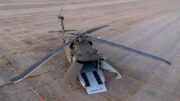
SNC’s DVEPS to Give the US Army’s Autonomous Black Hawk
Enhanced Environmental Perception
The planned integration of Sierra Nevada Corporation’s
multi-sensor system on the H-60Mx marks a step towards autonomous helicopter
operations in degraded visual environments, building on technologies already
used to assist crewed aircraft.
14 October 2026 –Sierra Nevada Corporation (SNC) has
announced that the US Army plans to equip its experimental H-60Mx autonomous
Black Hawk helicopter with the company’s Degraded Visual Environment Pilotage
System (DVEPS), a multi-sensor suite designed to provide environmental
perception in conditions that severely restrict conventional vision.
In a press release dated 13 October 2026, entitled “Army
Turns to SNC All-Weather Vision System to Give Autonomous Black Hawk Its ‘Eyes’,
SNC said the system was scheduled for installation during the first quarter of
fiscal year 2027. DVEPS is intended to serve as the aircraft’s primary
perception sensor, helping it navigate through dust, fog, smoke and darkness.
The announcement follows an earlier milestone reported by
the US Army on 20 March 2026, when the service confirmed receipt of its first
H-60Mx Black Hawk modified to operate with or without a pilot at the controls.
The aircraft is based on Sikorsky’s fly-by-wire technology and MATRIX autonomy
suite, developed through the Defense Advanced Research Projects Agency’s
(DARPA) Aircrew Labor In-Cockpit Automation System (ALIAS) programme.
The Army described the H-60Mx as a test platform for
advancing autonomous flight and evaluating additional mission-specific sensors
and systems.
From pilot assistance to autonomous perception
DVEPS addresses one of the major challenges facing
helicopter operations: maintaining reliable environmental awareness when dust,
sand, snow or other obscurants eliminate the visual references needed for safe
manoeuvring and landing.
According to SNC, the configuration planned for the H-60Mx
combines lidar and passive infrared imagery to generate a continuously updated
three-dimensional model of the surrounding terrain. This enables the aircraft’s
autonomy software to use processed environmental information rather than
relying solely on conventional camera imagery. DVEPS technology can also
support piloted helicopters, enhancing crews’ situational awareness in degraded
visual environments.
Lidar measures distances to surrounding surfaces and
obstacles, while infrared imaging provides complementary information in
low-light conditions. The fused data can help identify terrain features and
hazards during approach, hover and landing.
The distinction is important. In a conventional crewed
helicopter, a DVE (Degraded Visual Environment) system presents enhanced visual
information to the pilot, who interprets the display and controls the aircraft.
On the autonomous H-60Mx, DVEPS is intended to provide environmental perception
to the aircraft’s autonomous flight system, supporting its own navigation and
manoeuvring decisions.
SNC describes the installation as a step towards extending
autonomy into conditions in which conventional cameras and human vision become
unreliable. The planned integration and subsequent testing will determine how
effectively the system supports the H-60Mx in operationally relevant
conditions.
A broader sensor-fusion architecture
Although the configuration announced for the H-60Mx
specifically identifies lidar and passive infrared imagery, SNC’s wider
degraded visual environment portfolio supports a broader combination of sensing
technologies.
The company’s DVE solutions can integrate lidar, radar and
high-resolution passive sensors, with their data fused through its Sierra
Fusion three-dimensional world model. The architecture aligns and geo-registers
sensor imagery to produce a coherent representation of the environment.
Radar can provide complementary information when atmospheric
obscurants affect optical sensors, while lidar contributes detailed range
measurements and passive imaging adds visual or thermal information. Their
respective strengths can reduce reliance on any single sensing modality.
SNC also describes capabilities for terrain and obstacle
detection, proximity alerts, hazard identification and landing-zone assessment.
Its wider portfolio supports both crewed and uncrewed aircraft.
However, the company’s general DVE architecture should not
be confused with the precise sensor configuration announced for the H-60Mx. The
October press release does not confirm that a millimetre-wave radar or every
other sensor available across SNC’s portfolio will be installed on this
particular aircraft.
Nor does sensor fusion guarantee detection of every obstacle
in every condition. Performance depends on sensor coverage, range,
environmental conditions, data processing and the ability of the autonomous
system to respond safely to detected hazards.
Comparable systems for crewed helicopters
DVE technology is not limited to autonomous aircraft.
Several manufacturers have developed systems that enhance a human pilot’s
perception in low visibility, although their architectures and intended uses
differ. The difference with DVEPS lies in the fact that the DVEPS planned for
the H-60Mx is intended to provide environmental perception data to the
helicopter’s autonomous flight system.
Lockheed Martin’s Pilotage Distributed Aperture Sensor
(PDAS) provides real-time, multispectral 360-degree imagery through six
infrared sensors distributed around the aircraft. Its processor combines the
imagery into a panoramic view and supports sensor fusion and threat detection.
The system is designed to improve crew situational awareness in conditions such
as fog and brownout.
Elbit Systems’ DVE/LVL solution focuses on helping
helicopter crews maintain visual references during degraded-visibility and
low-visibility landing operations. Based on its Helmet Display and Tracking
System, it overlays three-dimensional landing and mission symbology onto the
pilot’s view, helping crews assess lateral drift and manoeuvre when external
visual references are limited.
Thales TopOwl and WASP helmet-mounted systems provide
another European approach to degraded visual environment (DVE) operations.
TopOwl combines helmet-mounted symbology and synthetic terrain representations
with imagery from compatible onboard sensors, including infrared cameras and
night-vision systems, depending on the aircraft configuration. Thales’ WASP
system supports the display of electro-optical (EO), infrared (IR) and
Distributed Aperture System (DAS) sensor data, helping pilots maintain
situational awareness when external visual references are limited.
An important step towards all-weather helicopter autonomy
SNC’s announcement highlights the growing importance of
environmental perception as military aviation moves beyond automated flight
controls towards more capable autonomous aircraft.
The H-60Mx already provides a platform for evaluating the
MATRIX autonomy suite in reduced-crew and uncrewed configurations. Adding DVEPS
is intended to address a different but complementary challenge: enabling the
aircraft to perceive terrain and obstacles when conventional visual references
deteriorate.
For the US Army, the planned trials will help assess how
sensor fusion can support autonomous helicopter operations in demanding
environments. For SNC, the programme extends its DVE technology into a role in
which the system’s output must support machine decision-making, rather than
simply improve a pilot’s view.
The decisive test will be whether the integrated system can
provide sufficiently reliable environmental information for the aircraft to
manoeuvre and land safely across a representative range of degraded visual
conditions.
Source: Sierra Nevada Corporation (SNC)